Log in
All resources
Create a design
185 Free Artworks of Maps Of Wales
bibliothèque nationale de france
british museum
augustine ryther
bowes playing cards bm 1938,0709.57.1-60
pasteboard
elizabeth i, queen of england
maps of wales by humphrey llwyd
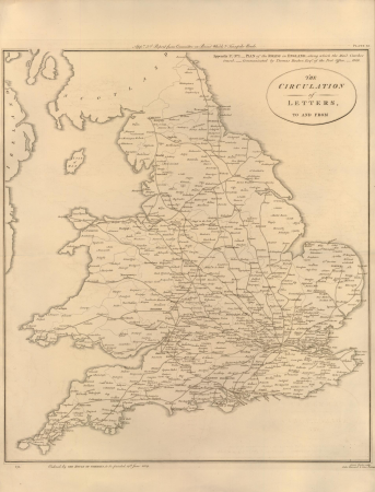
cary's new itinerary (1815)
17th-century maps of england and wales
miniature speed atlas (1627) pieter van den keere
description de l'universe
1680s maps of england
maps in the british museum
james basire
bowes playing cards bm 1938,0709.57.1-60
augustine ryther
description de l'universe
1680s maps of england
chorographia britanniae (1741-1742)
bibliothèque nationale de france
bibliothèque nationale de france
maps of wales by humphrey llwyd
18th-century maps of england and wales
chorographia britanniae (1741-1742)
miniature speed atlas (1627) pieter van den keere
old county maps of leicestershire
miniature speed atlas (1627) pieter van den keere
old county maps of gloucestershire
miniature speed atlas (1627) pieter van den keere
old county maps of huntingdonshire
miniature speed atlas (1627) pieter van den keere
old county maps of derbyshire
miniature speed atlas (1627) pieter van den keere
old maps of the hebrides
maps by peter lesley
maps by james hall
maps of wales by humphrey llwyd
maps by pieter van der keere
bowes playing cards bm 1938,0709.57.1-60
augustine ryther
bowes playing cards bm 1938,0709.57.1-60
augustine ryther
bowes playing cards bm 1938,0709.57.1-60
augustine ryther
bowes playing cards bm 1938,0709.57.1-60
augustine ryther
bowes playing cards bm 1938,0709.57.1-60
augustine ryther
bowes playing cards bm 1938,0709.57.1-60
augustine ryther
bowes playing cards bm 1938,0709.57.1-60
augustine ryther
bowes playing cards bm 1938,0709.57.1-60
augustine ryther
bowes playing cards bm 1938,0709.57.1-60
augustine ryther
bowes playing cards bm 1938,0709.57.1-60
augustine ryther
bowes playing cards bm 1938,0709.57.1-60
augustine ryther
bowes playing cards bm 1938,0709.57.1-60
augustine ryther
bowes playing cards bm 1938,0709.57.1-60
augustine ryther
bowes playing cards bm 1938,0709.57.1-60
augustine ryther
bowes playing cards bm 1938,0709.57.1-60
augustine ryther
bowes playing cards bm 1938,0709.57.1-60
augustine ryther
1890s maps of england
1890s maps of wales
arnold's geographical handbook (1899)
1890s maps of england
atlas maior, vol 5 (england) - joan blaeu, 1667 - bl 114.h(star).5
17th-century maps of england and wales
maps of wales by humphrey llwyd
ateliers bmb mercator
atlas sive cosmographicae (gerardus mercator, 1630)
maps of england by gerardus mercator
18th-century maps of england and wales
chorographia britanniae (1741-1742)
bodleian maps collection
1610s maps of the world
maps of cornwall and south wales by gerardus mercator
ateliers bmb mercator
17th-century maps of england and wales
maps by jodocus hondius
bibliothèque nationale de france
maps of wales by humphrey llwyd
maps from the earth and its inhabitants, vol. xiv
old maps of sydney
maps from the earth and its inhabitants, vol. xiv
old maps of sydney
17th-century maps of pembrokeshire
maps by jodocus hondius ii
bibliothèque nationale de france
maps of wales by humphrey llwyd
19th-century maps of new south wales
australia (1873) by booth
19th-century maps of gloucestershire
old maps of cheltenham
admiralty charts region b: england wales ireland english channel southern north sea
admiralty charts 1001-1200
bibliothèque nationale de france
maps of wales by humphrey llwyd
atlas sive cosmographicae (gerardus mercator, 1607)
maps of wales by humphrey llwyd
atlas sive cosmographicae (gerardus mercator, 1623)
maps of wales by humphrey llwyd
maps by jodocus hondius
maps by john speed
maps by jodocus hondius
maps by john speed
17th-century maps of pembrokeshire
old county maps of pembrokeshire
chorographia britanniae (1741-1742)
18th-century maps of monmouthshire
bibliothèque nationale de france
maps by thomas kitchin
maps by john cary
1801 maps
maps of cornwall and south wales by gerardus mercator
atlas sive cosmographicae (gerardus mercator, 1623)
17th-century maps of carmarthenshire
17th-century maps of pembrokeshire
theatrum orbis terrarum (1606 bodleian)
maps of wales by humphrey llwyd
admiralty charts region b: england wales ireland english channel southern north sea
admiralty charts 2401-2600
atlas ou representation du monde universel t. 1 (1633)
maps of england by gerardus mercator
19th-century maps of england and wales
a system of modern geography (1810)
atlas sive cosmographicae (gerardus mercator, 1630)
maps of wales by humphrey llwyd
atlas sive cosmographicae (gerardus mercator, 4th edition 1613)
maps of wales by humphrey llwyd
maps of cornwall and south wales by gerardus mercator
atlas sive cosmographicae (gerardus mercator, 1630)
prints by james gillray in the british museum
satirical prints in the british museum
cartography
maps
bibliothèque nationale de france
maps by thomas kitchin
bibliothèque nationale de france
maps by thomas kitchin
admiralty charts 2001-2200
westport, county mayo
17th-century maps of england and wales
maps by willem and johannes blaeu
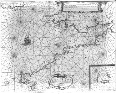
canalis celebris vel navigationis à bristovio, atque totius situs inter galliam belgicam et britanniam accurata delineatio, eiusdemque terrae verus vultus cum suis miliaribus, ventis ac ascendentibus -... - btv1b53225454g
bibliothèque nationale de france
canalis celebris vel navigationis à bristovio, atque totius situs inter galliam belgicam et britanniam accurata delineatio, eiusdemque terrae verus vultus cum suis miliaribus, ventis ac ascendentibus -... - btv1b53225454g
bibliothèque nationale de france
canalis celebris vel navigationis à bristovio, atque totius situs inter galliam belgicam et britanniam accurata delineatio, eiusdemque terrae verus vultus cum suis miliaribus, ventis ac ascendentibus -... - btv1b53225454g
bibliothèque nationale de france
19th-century maps of the isle of wight
cary's new itinerary (1815)
19th-century maps of middlesex
cary's new itinerary (1815)
19th-century maps of england and wales
cornell's primary geography (1860)
19th-century maps of hampshire
cary's new itinerary (1815)
19th-century maps of somerset
cary's new itinerary (1815)
cary's new itinerary (1815)
19th-century maps of kent
1813 in prospect, new south wales
veteran hall remains
nature
maps
the castles and abbeys of england (1844)
floor plans of tintern abbey, wales
prints by james gillray in the british museum
satirical prints in the british museum
prints by william dent in the british museum
satirical prints in the british museum
101 - 185 of 185
/ 2


![Cambriae typus / Auctore Humfredo Lhuydo Denbigiense Cambrobritanno; Petrus Kaerius coela[vit], 1607](https://cdn.creazilla.com/illustrations/10000351350/cambriae-typus-auctore-humfredo-lhuydo-denbigiense-cambrobritanno-petrus-kaerius-coelavit-1607-md.jpg)


![[Edward Wright, Chart of the World ], Edward Wright, 1610](https://cdn.creazilla.com/illustrations/10000975501/edward-wright-chart-of-the-world-edward-wright-1610-md.jpg)


![Gerardi Mercatoris and I. Hondii Atlas or Representation of the Universal World, and of the Parts of It, Made in Tables and Descriptions Very Ample, and Exact: Divided into Two Volumes [...]. [t. 1].](https://cdn.creazilla.com/illustrations/10000720637/gerardi-mercatoris-and-i-hondii-atlas-or-representation-of-the-universal-world-and-of-the-parts-of-it-made-in-tables-and-descriptions-very-ample-and-exact-divided-into-two-volumes-t-1-sm.webp)


![The Jersey smuggler detected; - or - good causes for discontent [separation], James Gillray, 1796](https://cdn.creazilla.com/illustrations/10000249640/the-jersey-smuggler-detected-or-good-causes-for-discontent-separation-james-gillray-1796-md.jpg)
